
Stowe (CDP), Vermont
With the passage of time, Stowe (CDP), Vermont has become a topic of great relevance in our society. More and more people are looking for information about Stowe (CDP), Vermont, either out of personal interest or the need to be aware of the latest developments in this field. Stowe (CDP), Vermont has been the subject of numerous studies and investigations that have yielded surprising results, sparking the interest of experts and hobbyists alike. In this article, we will explore the different aspects related to Stowe (CDP), Vermont, its impact on our lives and the vital role it plays in various areas.
Stowe, Vermont | |
|---|---|
,_Vermont&sq=Stowe_(CDP),_Vermont&lang=en&file=File:USA_Vermont_relief_location_map.svg) Stowe Location in Vermont ,_Vermont&sq=Stowe_(CDP),_Vermont&lang=en&file=File:Usa_edcp_relief_location_map.png) Stowe Location in the United States | |
| Coordinates: 44°27′55″N 72°41′8″W / 44.46528°N 72.68556°W | |
| Country | United States |
| State | Vermont |
| County | Lamoille |
| Town | Stowe |
| Area | |
• Total | 0.82 sq mi (2.13 km2) |
| • Land | 0.81 sq mi (2.11 km2) |
| • Water | 0.0077 sq mi (0.02 km2) |
| Elevation | 723 ft (220 m) |
| Population | |
• Total | 495 |
| • Density | 608/sq mi (234.6/km2) |
| Time zone | UTC−5 (Eastern (EST)) |
| • Summer (DST) | UTC−4 (EDT) |
| ZIP Code | 05672 |
| Area code | 802 |
| FIPS code | 50-70450[1] |
| GNIS feature ID | 2586656[3] |
Stowe is a census-designated place (CDP) comprising the central community in the town of Stowe, Lamoille County, Vermont, United States. As of the 2010 census the population of the CDP was 495,[2] out of 4,314 in the entire town.
Geography
Stowe village is in the eastern part of the town of Stowe, along the Little River where it is joined by the West Branch. Vermont Route 100 passes through the village, leading north 9 miles (14 km) to Morrisville and south 10 miles (16 km) to Waterbury and Interstate 89. Vermont Route 108 has its southern terminus in Stowe village and leads north through Smugglers Notch 17 miles (27 km) to Jeffersonville.
According to the United States Census Bureau, the Stowe CDP has a total area of 0.81 square miles (2.1 km2), of which 0.01 square miles (0.02 km2), or 1.02%, are water.[1] Via the Little River, Stowe is part of the Winooski River watershed draining westward to Lake Champlain.
References
- ^ a b c "2020 U.S. Gazetteer Files: Vermont". United States Census Bureau. Retrieved February 11, 2021.
- ^ a b "Total Population: 2010 Census DEC Summary File 1 (P1), Stowe CDP, Vermont". data.census.gov. U.S. Census Bureau. Retrieved February 11, 2021.
- ^ "Stowe Census Designated Place". Geographic Names Information System. United States Geological Survey, United States Department of the Interior.
Municipalities and communities of Lamoille County, Vermont, United States | ||
|---|---|---|
| Towns | 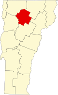 | |
| Villages | ||
| CDPs | ||
| Other communities | ||